A long-imagined canoe trip in our own back yard
We had set aside a 3-day weekend, Halloween weekend, for a canoe trip. In September and October it's hard to imagine that the pleasant temperatures and sunshine will end. We always want to do one more canoe trip. Last year we paddled the Black River in November. We persuaded several friends to paddle with us that time. The weather turned out to be colder, windier, and wetter than hoped for on the Black River trip. None of our friends were available to paddle with us this time.Two years ago, we paddled from Ann Arbor at Geddes Pond to Lake Erie Metropark. Ever since, we have wanted to paddle the entire 104 mile Huron River. It is right in our backyard and has some really beautiful sections, pretty clear water, and a few fun riffles and rapids. We figured this would be a good chance to do it.

The Huron River Water Trail organization publishes detailed maps of the route, posts fun mile marker signs along the way, and advocates for portage routes and canoe camp sites in the Metroparks. The route passes through seven of the Huron-Clinton Metroparks, eight if you go all the way to Lake Erie Metropark. The Metroparks have several canoe-in only campsites that can be reserved. We called ahead to arrange for campsites at Hudson Mills and at Lower Huron Metroparks.
The portages are a significant challenge. The route portages over 11 dams. Upstream of Ford Lake, the Huron River Water Trail does a nice job of ensuring good portage routes. However, in the lower river you are on your own. The portages at Ford Lake and Belleville Lake are long and arduous. The "Safe Portage" at Belleville Lake Dam is rather sketchy, due to tall sheet piling and steep stairs. Unfortunately, at Flatrock Dam, there is no public portage route owing to fences on both sides of the dam. We called ahead to Flatrock Metals and asked them to leave their gate unlocked for us. We hoped that they would remember this time, unlike last time. We also had our portage wheels and were prepared to wheel the canoe a few miles through Flatrock if we found that the gate was locked.

Dan Klinkhammer sent us a writeup of his record-setting run down the Huron with Bill Dubois in 2008. They are Michigan Canoe Racing Association racers and ran the river in the style of the Au Sable Canoe Marathon in a light, fast "pro-boat". They started at the Bass Lake Road boat launch in Proud Lake State Recreation Area just before midnight on May 24. Dan and Bill navigated fog, darkness, and 11 portages to arrive at the Point Mouille boat launch in exactly 18 hours. According to Dan, the previous record was 19 hours 45 minutes. We would not be setting any records, but we decided to visit the "official" start and finish locations.
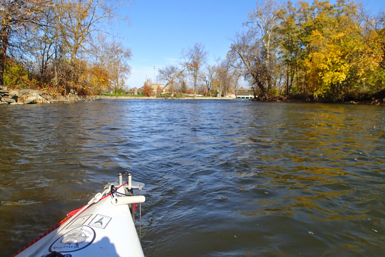
Put-in at Proud Lake
The forecast told us that summer was over: rain on Friday with wind increasing throughout the day, turning to snow and storm-force winds from the north Friday night. It was predicted to clear up on Saturday, with wind gradually decreasing. High temperatures were predicted in the 40s with lows in the 20s making for cold camping conditions.
We put-in at the Proud Lake campground boat launch and parked near the gatehouse. There was no one to be seen in the park on a cold, rainy morning, so we hoped it was OK to park there. We hit the water at the not-too-early hour of 9:15 AM, in spite of our best intentions to start earlier. We knew that we would not make it to Huron Meadows before dark, but we were prepared for night paddling.

It added half a mile, but we had to start at the "official" start; the Bass Lake Road launch.


The first portage is at the end of Proud Lake.


We had to get out of the boat for that tiny weir? However, it was the best developed portage on the route, with the wooden ramps and plastic mesh to keep the boat from dragging on the gravel. Just a warmup for things to come...

At Milford, we were in familiar territory. We often put in at Kent Lake for day paddles.


Some day we'll stop in at the River's Edge Brewing Company in Milford, but it was a little early yet and we had many miles to go.

The second portage is at Hubbell Pond: mile marker 98.

Boat rollers: a novel concept, although it's a little tricky to balance.


Several deer crossed the river in front of us on the approach to Kent Lake.


The wind was beginning to build as we crossed Kent Lake.

Lunch at Kent Lake
Kathy and Ender surprised us with lunch at the Kent Lake portage.

The river below Kent Lake dam is familiar from winter paddles with Dan Klinkhammer and the MCRA racers. The rain picked up again.


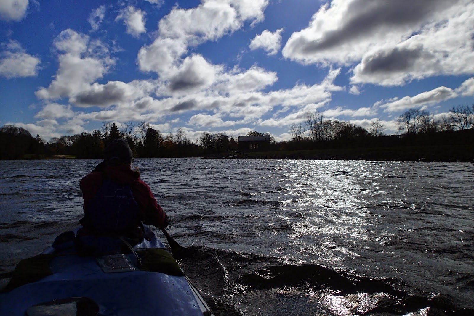
The wind continued to build. We crossed Strawberry Lake on a beam reach. We were glad we decided to bring the Cruiser and not the pro-boat.


We stopped for a short break before facing the wind on Baseline lake.


It was nearly dark at Flook Dam, and beginning to snow. The first winter storm of the season.


Camp 1: Hudson Mills Canoe Camp
It was only a short paddle in the dark from Flook dam to Hudson Mills Canoe camp at mile marker 67. It would not have been easy to find in the dark, but I had marked a GPS waypoint for the outhouse that we spotted on Google Earth.
The wind continued to build overnight. The roar of the wind in the treetops woke us up, and inspired thoughts of trees crashing down. Fortunately, the trees held firm.
The "Halloween Storm" produced 22 ft waves and early lake effect snow on Lake Michigan. Gusts to 38 mph were recorded in Ann Arbor, and up to 60 mph along Lake Michigan.
In the morning there was just a light dusting of snow on the tent.

Frozen Fingers
Packing up camp is always the worst time of day for frozen fingers.
A tornado flattened trees near Dexter in 2012.


There is a significant rapid at Delhi Metropark that can be fun to run if there is enough water. We scouted it, and decided to portage. We would be scraping over rocks in the loaded Cruiser.

Breakfast on the river consisted of pumpkin-nut-chocolate-chip bread from Kathy and hot coffee mocha from the thermos.

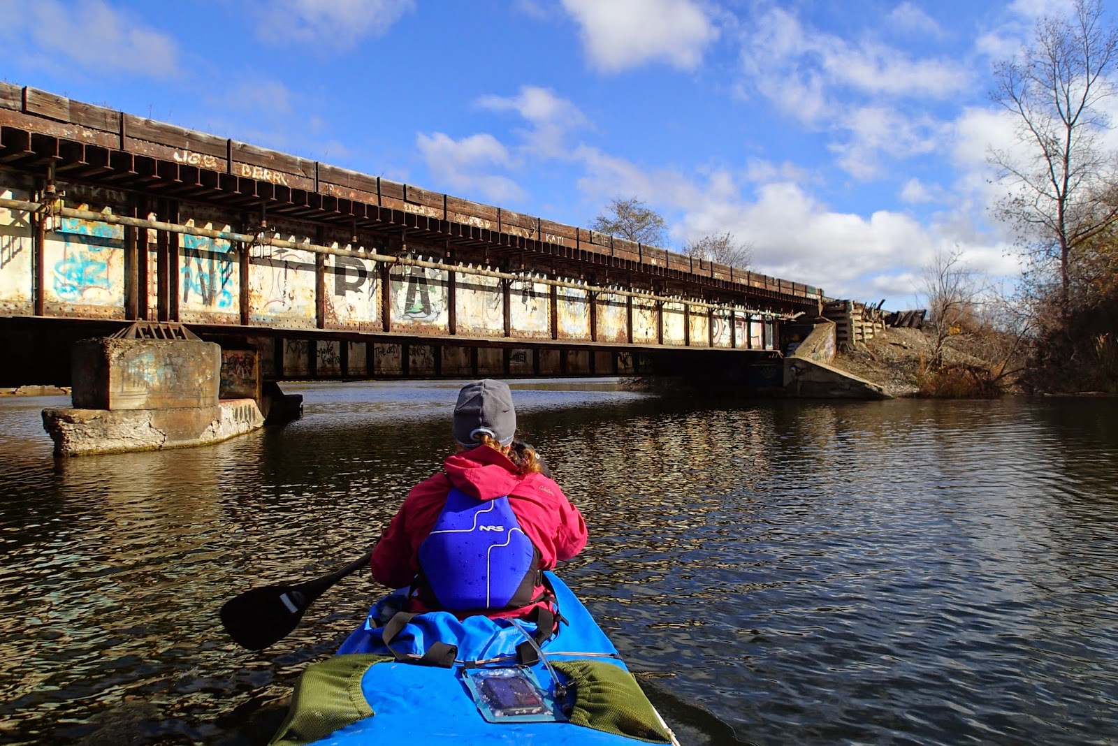
Graffiti on the bridges marked the start of the urban section through Ann Arbor and Ypsilanti.
Giant mansions overlook Barton and Argo ponds on the approach to Ann Arbor.

The wind was still strong, and gave us a nice push down Barton Pond.
It was here that we noticed our portage cart tire had gone flat. Efforts to pump it up went for nought. We would just have to pull harder on the portages.

We had heard of the "Cascades", a whitewater park bypassing Argo Dam, but we had never seen them before. Water sucks into a narrow gap in a concrete wall at the entrance; not something we would normally want to paddle into, but we supposed it was built for that purpose so it must be OK.


The cascades were way more fun than a portage; they should build these at every dam! An audience followed us on the walking path as we carefully lined up on each drop and eddy-turned out below. We did not want any mishaps in the cold water.


Halfway!
We were more than halfway to Lake Erie at Superior Portage; however, it seemed that the miles were accumulating more slowly than the day was passing. Portages take time. It was shaping up to be another arrival at camp after dark. We hoped to be able to portage the Hobo country of Belleville dam before dark, so we had to keep our pace up.


There was a nice new floating dock at Peninsular Paper Dam. Unfortunately, the 90 degree turn between the narrow railings on the walkway and wooden retaining wall required us to lift the loaded boat up over the railing to make the turn. We need to spend more time at the gym!

The water is fast and fun through Ypsilanti. Imagine how fun the river would be if all those dams didn't make a series of ponds on the steep drop through Ann Arbor and Ypsi.
It took courage to keep paddling past the Corner Brewery in Ypsi.


Ford Lake and Belleville Lake
The wind was gradually decreasing, but we still got a nice push around the first bend on Ford Lake.

On our 2012 trip, we portaged on the right at Ford Lake Dam, which involved pulling over a guardrail. I scouted a route on Google Earth that looked like an easy-wheeling trail to the road and park. Unfortunately, the trail lead to a hole in the fence that was too small for a canoe. We backtracked to the dam. It was a long drag on the flat tire of the portage cart.

As we entered Belleville Lake, I felt optimistic that we might make the portage before dark. We paddled hard as the setting sun colored the clouds and flocks of gulls whirled around.


We arrived at the Belleville Dam portage in the last light of the setting sun. With the flat tire, we would not make the portage before dark.

Fortunately, we did not meet any hobos in the dark under the old railroad bridge. In 2012 there was a chain link fence along the 10-foot wall of sheet piling, but the fence had been removed so there was nothing to keep us from falling into the river on the approach to the narrow stairs.


It was a relief to be past the last portage of the day. It was an easy paddle in the dark on familiar waters to cover the last few miles to the Lower Huron Metropark canoe camp.

Once again, we cooked under the vestibule from inside our sleeping bags. The sky was clear and the temperature was already well below freezing. Although, it actually stayed warmer inside the tent than the previous night because the wind was much less.

Frozen Fingers Again
Everything was frozen and frosty in the morning, which made for frozen fingers after packing up camp.
Handwarmers inside shell mits brought our fingers back to life as we paddled through the morning mist.


The lower river
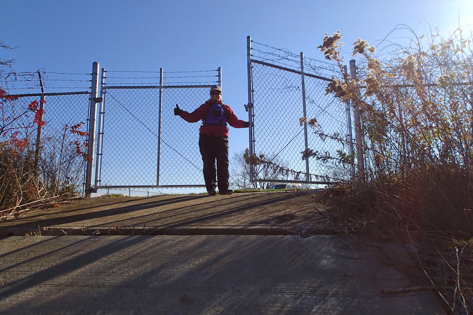
The lower river meanders lazily through wooded metroparks. Would the gate at Flatrock be unlocked, or would we have to drag the canoe a few miles through town on a flat tire?

It's unlocked! Thank you, Flatrock Metals.


With the last portage out of the way, we knew we had it in the bag.

We were surprised to see our friend Jerry had paddled up from Lake Erie to meet us. It was his first time on the water since the car accident. It really brightened our spirits to see him.


Pointe Mouillee


We made it!

We continued on to Erie Metropark boat launch, which allowed safe overnight parking. It was a beautiful calm and moderately warm day on Lake Erie.


Stats from the GPS
103 miles24 hr 15 min moving time
About 50 hr overall time
7.5 mph max
4.3 mph moving avg
The elevation and speed plot can be seen below. The river is flat through the lake country, steeper through Ann Arbor and Ypsilanti, you can see the big steps from the dams, then flattens out around Flatrock on the approach to Lake Erie.

Nice report! Thanks.
ReplyDeleteInspiring! Thanks for sharing this!
ReplyDeleteWould the author please contact me at eriggs@hrwc.org about gaining permission to use some of the images for education purposes? Thanks
ReplyDeleteThis comment has been removed by a blog administrator.
ReplyDelete