Days 5-6: South Joe River Chickee to Key Largo
Wednesday-Thursday, March 9-10

Once again, the alarm woke us after four hours of sleep. We might have slept longer, but we heard a forecast that indicated a slight reduction in the headwind to 15 mph for the afternoon and evening, then back up to 20-25 mph through Sunday. Also, we expected that a rising tide around 10 AM might give us a favorable current in Tin Can Channel. So, for these reasons, and a general desire to just get this thing over with, we stuck with four hours of sleep as we had each night. We had no break from the wind, as it had been blowing across the chickee all night at full force.
More slogging into headwind for the final miles of Joe River.


Coot Bay was especially rough.

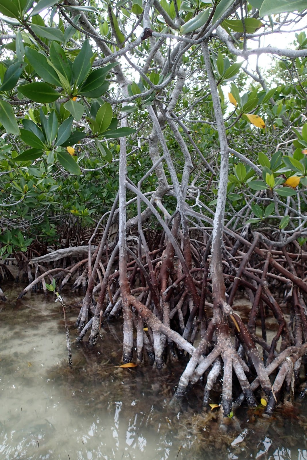
We finally entered the shelter of Buttonwood Canal, and enjoyed calm conditions for the last 2.5 miles into Flamingo.

Bob and Janet Bradford, Doug Cameron, and Graybeard welcomed us in to Checkpoint 3 at Flamingo. "We were surprised you stopped last night", Bob said, "We thought you might just keep going". Well, I thought we might want some rest before taking on Florida Bay. "Good idea!"
I discussed the route with this illustrious group of EC veterans, and it seemed like the twisty mile route might offer the best possibilities for shelter.

We got out the portage cart, wheeled the boat over to the saltwater side, filled up the water, mixed up some Spiz, and launched again. A manatee surfaced next to the boat as we were zipping our spray covers.

It is 34 miles due east from Flamingo to Key Largo. We were expecting east-southeast wind at 15-25 mph with stronger gusts right on the nose the whole time. The forecast we saw indicated that these conditions would last through Sunday, so waiting would not help. We also saw in the SailFlow forecast that the wind gets stronger the closer we get to the keys, which was not encouraging.

Why did I even think this might be possible? Well, a few years ago I would not have considered trying it. However, as we have gotten to know the EC veterans and their stories, we figured that even if we had to crawl along at 1mph, we could still make it; we had three days yet to finish. From what I hear, strong southeast winds are not unusual in these parts, and many have finished the race under such conditions. Even IronBob and The Juice, who are usually the first paddlers to finish, had taken more than 24 hours to cross the bay on 3 out of 6 ECs, according to what Druce told me at DeSoto. This was somehow encouraging. It is also the case that we have completed a number of long and grueling events, which gave us the confidence that we could keep pulling for a few more days if necessary. We also knew that Sandy Krueger had slept in her boat on the bay overnight, pulled up in the lee of a mangrove island, and she reported having a good sleep. So, this was our plan. We had plenty of food and water readily accessible and were prepared to sleep in the boat for as many as two nights if necessary.
We left Flamingo at 10:30 AM. It was very windy, just as expected.

It is seven miles from Flamingo to Buoy Key up Tin Can Channel. We were pulling very hard and making 1-2 mph. We had hoped for a favorable current with the rising tide, but in fact there was a contrary current. Maybe the wind was blowing the water out of the bay. If either of us stopped paddling for a moment, we would start going backwards, so the only way to take a break was to grab onto a channel marker.

After four hours of hard pulling, we made it to Buoy Key, averaging 1.75 mph.


It's one thing to think about paddling for more than 24 hours, but once I felt how hard I would have to pull just to make 1.5 mph, my morale had reached a low point. I racked my brain for some other way to get to Key Largo. Even though I knew better, I was sufficiently desperate to think it might be a good idea to try sailing upwind.

Based on past experience, we can only make about 1mph upwind with our BSD sailing rig. However, paddling upwind was not much faster, so I convinced us to try it. We set up the rig and sailed for an hour. We made about 1 mile, and it was really not that relaxing. So, we packed in the sail and went back to paddling. No easy way out.

After three more hours of pulling, we arrived at Dump Keys. It was here that Lauren saw a text message on her phone to call home. Surprisingly we had a signal. Lauren's sister had her baby! We were aunt and uncle once again; little Jameson was born!


The entire backside of my body was very sore from pulling, but I had felt like this before and I knew I could keep pulling. We thought of the difficult events we had done in the past. We did the Iron Mushroom with our friend Jack "The Hammer", which involves paddling and poling 34 miles up the Little Manistee River. In the Iron Mushroom, we averaged about 1 mph, so it was a similar effort to what we were doing on Florida Bay. Just one Iron Mushroom to go!
Onward to End Key.


After two more hours of pulling, we reached the shelter of End Key. This is where Sandy Krueger passed the night in 2014, sleeping in her Kruger Sea Wind canoe. I recalled standing on the dock in Key Largo, looking out on the dark bay with the cold wind blowing, and worrying about her passing the night on the bay. But when she arrived she was perfectly happy and had a fine night.
We actually averaged better than 2 mph on the way to End Key. The wind had moderated slightly, so we decided take advantage of the situation and make a push for Jimmy Channel, which was six miles away. If we could get that far, we would feel like we were closer to Key Largo than to Flamingo.
We pulled hard from End Key to Twisty Mile. It was actually rather difficult to follow the Twisty Mile channel in the dark. I only had a few points marked on my GPS route, thinking that I would follow the channel markers from there. We shined our lights out over the windswept shoals, but it was not really possible to see the next set of markers from the previous set. We got off course into the shallows, but were able to keep the canoe moving in a few inches of water and eventually find our way back to the channel. Note to self: put more points on the GPS route.

At 9PM, we were at the end of Twisty Mile. Until now, the water had been very shallow, only a few feet deep, but we were on the edge of a 3.5 mile wide basin that was 7 feet deep. We knew that meant that the waves would be larger. We also knew that conditions got worse in 2014 when we exited Twisty Mile. However, we were fired up to push for Jimmy Channel, so we pressed on into the inky blackness.
At first it wasn't too bad because it took a while to reach the deeper water, so we were lured in. When we reached the deeper water, the seas were bigger than we anticipated. The waves come in sets that are sometimes called "the three sisters". When we got into a set, the bow would bounce over the first and dive into the second, then bounce over the second, and dive deep into the third, sending heavy spray flying over Lauren. I was also getting wet in the stern, but Lauren was getting completely soaked. The spray cover was keeping water out of the boat. I have an image in my mind of the faint red-green navigation light casting a glow on the face of muddy waves just before they crashed into Lauren.
We had to pull as hard as we could to keep the boat moving at 1 to 1.5 mph. Any slower than 1 mph, and the rudder quit working so the boat became difficult to steer. I had a waypoint on Jimmy Channel, but the red arrow on the GPS was pointing wildly every which way because the boat was not necessarily moving in the direction it was pointed. Fortunately, I could see the lights of Key Largo on the horizon, which provided reference points for steering.
It was difficult to talk over the noise of the wind. I called out our speed to Lauren for encouragement that we were actually moving. Looking at our speed and doing the math, it was clear that this would go on for hours before we would reach the other side. Exactly how many hours? It was hard to tell. I could not think about hours, I had to try not to think of time. Just keep pulling. I thought of the Au Sable River Canoe Marathon as a time when we thought we could not pull any longer, but we had to so we did.
The darkness, noise and chaos were like a sensory depravation chamber, which had the unfortunate side effect of encouraging sleepiness. Not a good time to get drowsy! I went through the techniques for staying awake that Micheal Doty had recommended. 1. Drink some coffee; No way I can make coffee under these conditions. 2. Paddle harder; I'm already paddling as hard as I can. 3. Do math problems. OK, I called out math problems to Lauren to keep her alert, and to know that she was awake. Normally we paddle in unison without difficulty, but she could not feel my pulls. I had to call out, "Pull, pull, pull!" to get us in sync.
I kept telling us that the waves would get smaller as the fetch decreased. But amazingly, they never did. It seemed like they were just as big when we finally reached the shoals of Jimmy Channel on the other side. It took 2.5 hours. Lauren grabbed onto a channel marker. We were finally across. It was 11:30 PM.

I imagined that we would pull into the lee of Manatee key for the night, but when I could finally get a free hand to work the GPS I found it was 1.5 miles away. That was too far. It would take another hour. A quarter mile to the north was a tiny, nameless mangrove island. We steered north into the shoaling waves and darkness. It was amazing how much faster we went when not pointed directly into the wind. There must be an island out here somewhere. Finally, there it was! We pulled into the calm in the lee of the island. It was like heaven to be out of the wind and waves!


I boiled water and made two Mountain House meals for us. Double servings of beef stroganoff. So good.

We had come 286 miles in five days. Must be getting close.

We pulled on rain gear over our wet clothes and hunkered down into the canoe. Soon we were fast asleep.

I awoke from a deep and dreamless sleep, surprised to find myself in a canoe. Don't roll over! It was dark and Lauren was snoring away in the bow. Little minnows were feeding on tiny particles in the water in the light of my headlamp. A mangrove crab was swimming around. The chorus of insects in the mangrove island was singing.

I took the opportunity to do a little route research. The standard route consisted of two open water crossings of three to four miles each, both would be directly into the wind. Still traumatized from our night crossing, I wanted to stick to the shallows if possible and avoid deep water crossings. I worked out a route through the shoals south of Manatee, Stake, and Bottle Keys. So far we had been able to slip over the shoals in a few inches of water, and I still believed that this part of Florida Bay had a sand bottom, not mud. When I later told this to Bob Bradford, he laughed a lot.

Time to get started. The wind was as strong as ever when we came out from behind the mangroves.


The wind was strong, but the shoals kept the waves small. My favorite yellow RKC hat blew away in this video. By the time I put down the camera and turned around it had disappeared into Davy Jones' Locker. Fortunately, I had a spare.


We paddled into a nature documentary. Dolphins were fishing in the shallow water by stirring up a plume of mud with their tails and swimming in a circle to contain fish within a curtain of muddy water. The dolphins and pelicans then dove into the circle of mud to grab the fish. We had recently seen this in a nature documentary, and now it was happening right next to us.
We were having good luck slipping over the shoals, and pulled in for a rest behind Low Key.


Just another two mile crossing of a shallow bay, pull over one last shoal, then another mile across the Key Largo Intracoastal waterway to Pigeon Key, and we would be in the home stretch.

The wind increased as the day progressed and as we approached the keys. After another hour of pulling, we reached the last shoal. It was too shallow to slip over. I imagined us walking down the shoal pulling the boat into the wind. I assumed the shoal was made of sand, so I suggested that Lauren step out. It turned out that there was a light crust over soft, gray clay mud. We both stepped out, and were gradually sinking deeper and deeper. It was not possible to walk, and I was afraid we would fall over, lose hold of the boat, and it would quickly be blown across the Gulf to Mexico. We got back in and paddled further looking for a gap in the shoal.

We found the best spot and pushed across skateboard-style with one foot in the boat and one foot in the mud.

We were across the shoal! Now, just another one mile crossing over the rough, windswept ICW channel to Pigeon Key.

After a rough crossing, we arrived in the lee of Pigeon Key. Now were were essentially at Key Largo. I supposed that we could sail the last 3.5 miles up the ICW channel, so we set up the sail.


I tied the sail into "storm sail" configuration. After our windy crossing of Florida Bay in 2014, I developed a way to tie the sail down even smaller than the second reef.
The point of sail turned out to be closer to the wind than I thought. We had to pinch and paddle to get around a lee shoal, but overall sailing was advantageous. It would have been a rough paddle.

After another hour, we made the final turn. We took down the sail for the last one mile slog directly into the wind to the Bay Cove. No break from the wind, even in the final mile!


The tribe welcomed us in, and The Juice handed us two cold beers. We made it!

Time to lounge around, watch the mantees, and swap stories with some amazing people.

By the numbers
Race results:
97 boats started the EC2016, 33 finished. This accounts for 10 boats that started the EC, but were reclassified to the Ultra Marathon in the results after retiring at Checkpoint 1.
Three boats started the EC in Class 3, and we were the only one to finish, making us the Class 3 winners. SOS finished ahead of us with his amazing Class 3 sailing canoe, but he was in the Ultimate Florida Challenge (and is still going as I write this!).
We were the first boat to finish the long route through the Everglades Wilderness Waterway, which is 20-30 miles longer than the shortest route.
We finished 17th overall, 5th among kayaks and canoes.
Stats from the GPS:
301 miles
9.4 mph max speed (sailing down Lemon Bay on Day 1)
3.6 mph moving average
3.2 mph overall average (GPS was off when camped)
83 h 32 min. moving time
10 h 48 min. stopped time (excluding camping)
How windy was it?
Here are screen shots of the wind observations from Key Largo and Flamingo after the fact (from Weather Spark). Wind was 15-25 mph with gusts in the 20-30 mph range. The highest sustained winds at Key Largo were on Thursday between about 10 AM and noon, which was the time when we were working our way from Manatee Key to Key Largo.


Here is out speed chart from the GPS. With good sailing on the first two days, we were a full day ahead of our 2014 pace by the time we reached Rodger's River Bay Chickee. Speeds on Florida Bay were in the 1-2 mph range.

Once again you have provided a wonderful account of your adventure, and even though I knew the out come, it was thrilling. Congratulations on a well deserved 1st.
ReplyDeleteI very much enjoyed your narration of your entire trip and all photos throughout. Thank you for sharing all those photos! I know how much time is spent taking photos and video while on the course; I've done the math. I agree with Jim, it was thrilling to read of your account of each hard earned step of your way across Florida Bay. It was like reliving some of my memories. We too, in desperation, have held onto various channel markers out there in Florida Bay. See ya paddling!
ReplyDeleteIm up in the black mountains at my sister cabin, with very poor internet connection, and browsing thru your photos and wishing i could click your video links.. after seeing your post to MM's best and worst Ec's.. I think I am ill, I can never get enough of checking this stuff out... Super high wind is the worst nemieis.... (sic, only cuz dont know how to spell) Look forward to being out on the water togeter.. Bermudaboy
ReplyDelete